

Track2Thermic 1.0
This software finds thermals in GPS track files and creates waypoints with info on thermal class, wind direction, climb rate, and initial altitude
Share
Edit
Rate this app
Program info
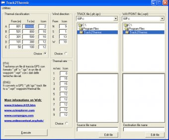
Track2Thermic is a software that helps pilots search and identify thermals, or ascending air currents, from GPS track files. It creates waypoints with information such as thermal class, wind direction, average climb rate, and initial altitude.
This software searches the track files downloaded from the GPS for ascending areas (thermals). For each thermal T2t creates a waypoint and assigns it a name that contains useful information, such thermal class, wind direction, average climb rate and initial altitude.
Details
Extensions

No information available
The data will be available later.Old versions

No information available
The data will be available later.


Comments